Archaeology at Curles Neck 44HE388

Feature and Artifact Data (Downloadable csv files)
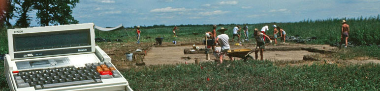
Excavations
During the first season in 1984, a walk-over survey identified the exposed remnants of a brick masonry structure. Artifact collection began in 1985 and continued until the conclusion of the project in 1997. Each artifact recovered from the site was assigned an Excavation Unit (EU) number corresponding to the context from which it was recovered. Archaeologists at Curles Neck used four different types of excavation context: surface collection grid, plowzone square, trench, and feature. Each context could contain multiple EU numbers, which were used to distinguish different stratigraphic layers, screened and unscreened sediment, and/or bisected features. All excavation contexts were recorded in reference to a metric grid system with an origin located about 200 meters south and west of the main excavation block.
Surface Collection
During the 1985 excavation season, the field containing 44HE388, which had recently been plowed for the first time in decades, was divided into 10 by 10 meter grid squares and artifacts were systematically collected from each square. This low-resolution survey allowed archaeologists to concentrate their efforts on sites dating to particular time periods. The southwest corner of each grid square was used to denote is northing and easting. All artifacts recovered from the same grid square were assigned a single EU number, making the surface collection grids the only excavation context where each context contained a single EU number.
Plowzone Squares
Beginning in 1985 and continuing until 1997, the plowzone was removed in contexts called plowzone squares. These squares were usually 2.5 x 2.5 m in size but were occasionally smaller on one or both sides. Each plowzone square was assigned a northing and easting based on the location of its southwest corner. During the first two excavation seasons (1985 and 1986), plowzone was not screened, though objects observed during excavation were recovered. ?Beginning in the 1987 excavation season, most units were divided into four equally-sized quadrants (called quadrates), and sediment excavated from the southwestern quadrate was screened. Artifacts recovered from screened quadrates were assigned a different EU number than those recovered from unscreened quadrates from the same plowzone square. Additionally, occasionally during block excavations, balks were left unexcavated within the bounds of particular plowzone squares to facilitate the removal of sediment from the site. Later, if these balks were excavated, they were assigned a new EU number which was also associated with the plowzone square context. Finally, intact stratigraphy uncovered beneath plowzone was occasionally excavated by plowzone square if the deposit extended across one or more squares. Thus, while some plowzone squares are associated with a single EU number, others contain several EU numbers.
Trenches
While trenches were often used as an excavation context in the first several field seasons at Curles Neck, they became less frequently used over time. Trenches are quite variable in dimension. They were typically rectangular with a length greater than 2.5 m and a width less than 2.5 m. Sometimes the entire trench was excavated as a single context, while other times unexcavated balks were left at regular intervals along the length of the trench. Sometimes trenches were only excavated to the base of plowzone in order to explore areas of interest without committing to block excavations, whereas other times trenches were excavated into deeply stratified features (like cellars or landscaping fill) in order to profile stratigraphic relationships and expose buried surfaces. Stratified deposits uncovered during trench excavation were assigned separate EU numbers and features found in trench floors and walls were assigned unique feature numbers. Typically trenches were aligned with the site grid, but occasionally (as with Trench 86-6) trench boundaries corresponded to feature boundaries. Trench naming systems are also inconsistent. In the 1985 and 1986 field seasons, trenches were numbered sequentially, and were only later divided by field season. Thus, trenches 1-3 were renamed 85-1 through 85-3, whereas trenches 4-6 were renamed 86-4 through 86-6. In 1987 trenches were named with letters (87-A and 87-B). Afterwards, trenches were named using the same system used for feature numbers: the last two numbers in the year ? a sequential number re-starting each year (ie. 93-1 for the first trench dug in 1993).
Features
Beginning in 1985, features identified beneath the plowzone were mapped, given unique feature numbers, bisected, and/or excavated. Unlike every other excavation context, the size and shape of features was not based on the site grid but instead based on the observed size and shape of distinct soil stains and architectural features. For the first three excavation seasons (1985 to 1987) each feature was assigned a sequential number in the order of discovery. Starting in 1988 and continuing for the rest of the project, feature numbers were assigned according to a new system: the last two numbers in the year ? a sequential number re-starting each year (ie. 88-1 for the first feature dug in 1988). After switching systems, the features excavated from 1985 to 1987 were switched into the new system but not re-numbered, thus the first feature excavated in 1986 was named 86-33 not 86-1, since it was the 33rd feature excavated overall. If a feature contained more than one layer of fill, then each layer was given a separate EU number. Additionally, many features were bisected in order to more easily map their profiles. In these cases, each bisected half was assigned a separate EU number. Occasionally the same physical feature was assigned multiple Feature numbers. In some cases, this was because the feature was identified and given a feature number during one field season but not excavated until a later field season. In other cases, two features that were seemingly unrelated were later discovered to be separate elements of the same feature. Most architectural elements (such as in-situ brick foundations or tile pavements) were given a single feature number, but in some cases they were mapped but not assigned a feature number.
 Curles Neck is licensed under a Creative Commons Attribution-NonCommercial 4.0 International License.
Archaeology Digital Data
Anthropology Department. Knoxville TN 37918
• Email: mfreem12@utk.edu
The flagship campus of the University of Tennessee System and partner in the Tennessee Transfer Pathway.