 Examining land ownership at Indian Camp
See also: Lesson plan
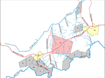
Overview: Students engage with changing land ownership at the Indian Camp plantation from 1710 through 1770, by reviewing maps, and related primary documents. How did rivers and roads affect development? What was the effect of land fragmentation and family ownership on the building of community, for both the land owners and their enslaved workers?
Use the module to answer the following questions:
- How does landscape change?
- Where did people first settle?
- What pieces of land are most desirable early on?
- How does landscape develop?
![]() Interactive Module (opens in a new window)
Interactive Module (opens in a new window)
![]() One page general overview of the context of the historical time in Virginia
One page general overview of the context of the historical time in Virginia
or download PDF copy
 Maps indicating the tidewater, piedmont, and mountain areas of Virginia
or download PDF copy


